0713033 – Geodesy and Cartography
CSGE “College of Geodesy and Cartography” provides an opportunity for students to study in the specialty qualification 0713033 – “technician – aerophotogeodesy»
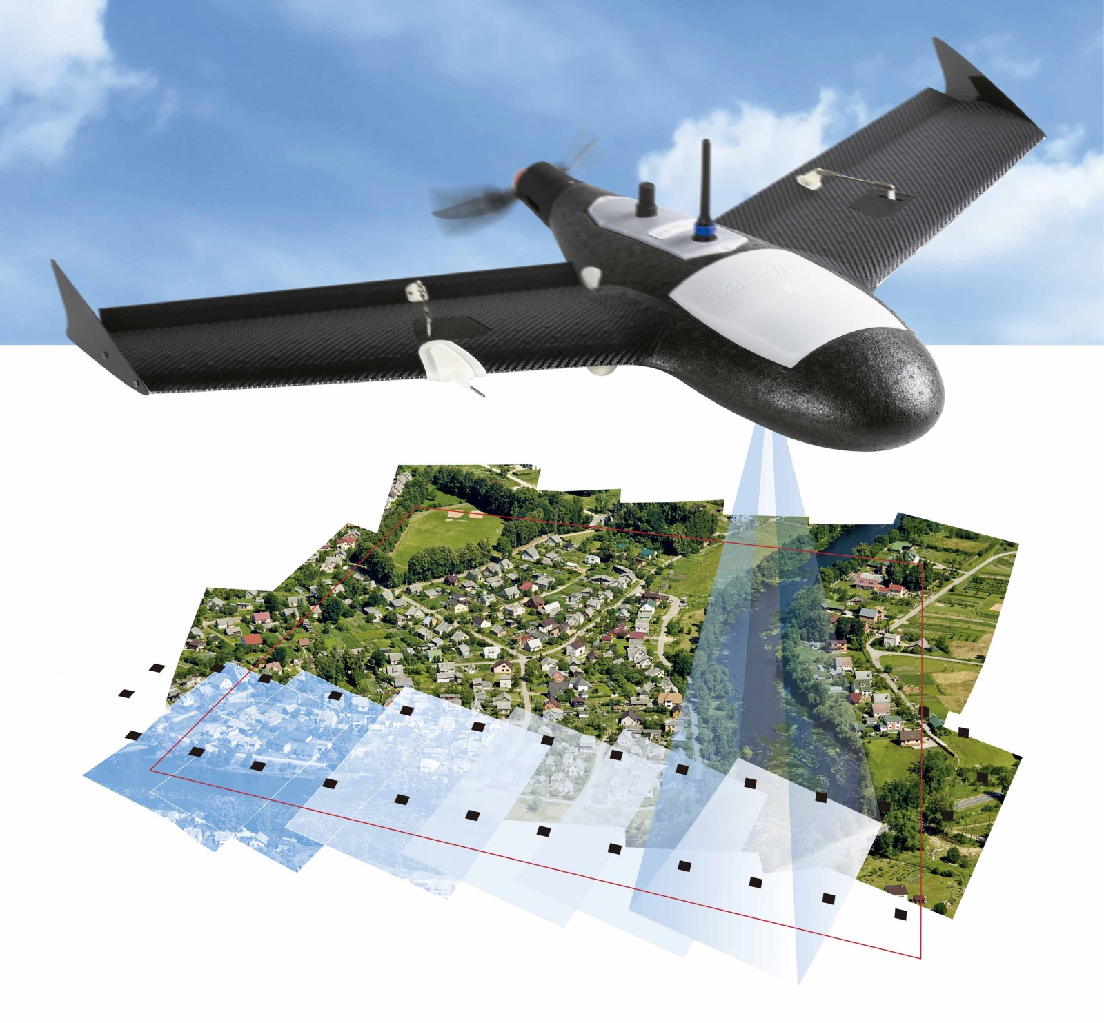
Equipment – aerophotogeodesy podgotavlivaya to perform topographic and geodetic works of the state mapping based on aerial survey data and kosmicheskoi shooting.
Tech – aerophotogeodesy” prepared:
* to carry out photogrammetric and stereotopographical work in the state mapping of the country based on aerial photography, space survey and ground-based methods of photographic survey;
- for photogrammetric and stereo-topographical work in the study of the Earth’s natural resources according to the materials of distance learning sensing (RS);
- for photogrammetric and stereo-topographical works in the design of large engineering structures on the distance learning materials sensing (RS);
- for photogrammetric and stereo-topographical works in the development of mineral resources according to the materials of distance learning sensing (RS) and ground-based phototheodolite shooting;
* in exploration works;
- to ensure the operational troops of the photographic and photogrammetric information obtained from a variety of media.
The middle-level professional qualifications 0713023 – “technology -aerophotogrammetric” can perform the following professional activities:
- industrial-technological;
* organizational and managerial;
* experimental.
Industrial-technological
* Photogrammetric thickening of geodetic justification of topographic surveys based on materials of Aero and space surveys;
* production of photogrammetric bases for stereotopographical survey at the state mapping, at studying of natural resources of the Earth, for design and construction of engineering constructions;
* stereotopographical survey in the state mapping of the country and the updating of topographic maps based on remote sensing data;
- photogrammetric measurements with observations of deformation and precipitation in the process of operation of engineering structures;
- periodic verification of the technical condition of the devices and making decisions about their fitness to work.
Organizational and managerial
* Organization of work of the team of performers;
* planning and organization of production works;
* ensuring safety at production sites.
Experimental
- development and implementation of new technology for photogrammetric and stereo photogrammetric work using modern equipment, devices and technical means.
Qualification 0713013 – “technician-surveyor”
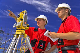
is the most common, widely used in various sectors of the economy. During construction, surveyors by various methods and devices with high accuracy ensure the installation of load-bearing columns, crane tracks and other related elements of buildings and equipment. At the final stage of construction technology surveyors are monitoring the status of buildings and structures. No construction can not do without the participation of the surveyor.
Technician-surveyor prepared:
* To professional activity on implementation of a complex of engineering and geodetic works at researches, design, construction and operation of engineering constructions;
- when you create a geodetic support of the inventory built-up areas;
* metrological support of geodetic works as a technique in organizations (enterprises) of engineering and geodetic profile of various organizational and legal forms and research organizations;
* to perform geodetic and topographic works in the state mapping of the country;
* in exploration works;
- for topographic and geodetic support for the troops.
The middle-level professional qualifications 0713013 – “technicians – surveyors” can perform the following professional activities:
- industrial-technological;
* organizational and managerial;
* experimental.
Industrial-technological
* Construction of geodetic justification for various engineering and geodetic works;
* implementation of geodetic preparation of the construction project and its removal into nature;
* geodetic observations during the operation of facilities;
* monitoring the implementation of field and office engineering and geodetic works in accordance with the requirements of existing regulations;
* monitoring the effective use of instruments and equipment;
- periodic verification of the technical condition of the devices and making decisions about their fitness to work.
Organizational and managerial
* Organization of work of the team of performers;
* planning and organization of production works;
* ensuring safety at production sites.
Experimental
- the development of new technologies perform engineering surveying works using modern equipment, devices and technical means.
Qualification 0713043 – “technician-cartographer”
creating a map – a complex process, the development of which is devoted to training in this specialty. The map is one of the greatest achievements of science and human culture. Without it, it is impossible to build cities, roads, irrigation and drainage systems, planning the economic development of the country. Without a map can not do scientists, pilots, sailors, explorers, travelers.
Cartographers are being prepared:
* To perform geodetic, topographic and photogrammetric works in the state mapping of the country;
* in exploration works;
* to perform geodetic, topographic and photogrammetric works in the survey, construction and operation of engineering structures of various types;
- for cartographic support.
Depending on the specifics of the sectors of the economy, as well as the order of employers for the training of specialists of average qualifications 0713043 technicians cartographers can perform the following professional activities:
- industrial-technological;
- production and management;
Industrial-technological
* Implementation of work in the field of drawing up, registration, preparation of maps for publication and their use;
* development of integrated and thematic mapping techniques;
- the practical solution of problems of mathematical cartography;
* implementation of work in the field of digital mapping products;
* participation in work to establish uniformity in the spelling of geographical names;
* implementation of work to create automated information
* search engines to provide a variety of queries about map sources.
Production and management
* organization of work of performers;
* planning and organization of production processes;
* implementation of quality control, work performed, safety at production sites;
* participation in the assessment of economic efficiency of production activities.
05 May 2018